
Ruins at Hastings Castle in 1983
Introduction
The photograph on this page of Ruins at Hastings Castle in 1983 by Clint Mann as part of the Geograph project.
The Geograph project started in 2005 with the aim of publishing, organising and preserving representative images for every square kilometre of Great Britain, Ireland and the Isle of Man.

There are currently over 7.5m images from over 14,400 individuals and you can help contribute to the project by visiting https://www.geograph.org.uk
Ruins at Hastings Castle in 1983
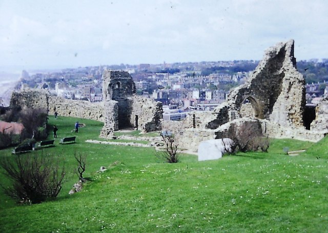
Image: © Clint Mann Taken: Unknown
View of ruins of Hastings Castle and St Mary's Chapel. Built in stone circa 1070, the castle was damaged by storms in 1287, by French attacks in 1339 and 1377, and by the dissolution of the monasteries in the 16th century, after which it was used for farming. Further damage was caused by bombing raids during the Second World War, then site became a tourist attraction in 1951. This image from 1983 looks beyond the castle to the town of Hastings and to the sea coast.
Images are licensed for reuse under creativecommons.org/licenses/by-sa/2.0
Image Location

Latitude
50.856098
Longitude
0.584742