Crawford Bridge
Introduction
The photograph on this page of Crawford Bridge by Philip Halling as part of the Geograph project.
The Geograph project started in 2005 with the aim of publishing, organising and preserving representative images for every square kilometre of Great Britain, Ireland and the Isle of Man.

There are currently over 7.5m images from over 14,400 individuals and you can help contribute to the project by visiting https://www.geograph.org.uk
Crawford Bridge
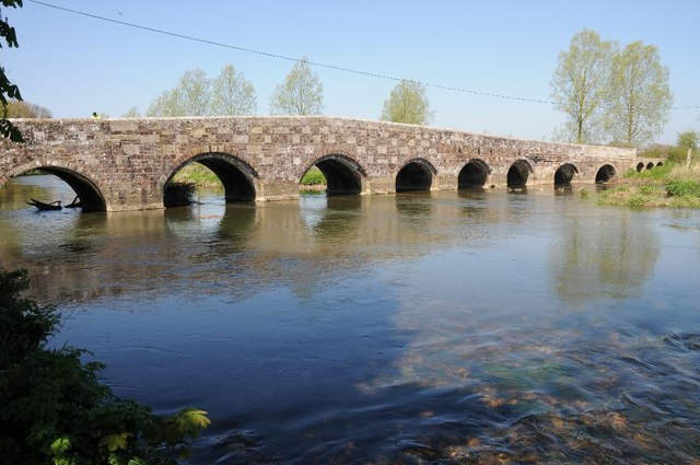
Image: © Philip Halling Taken: 16 Apr 2014
Crawford Bridge crossing the River Stour at Spettisbury, the date on the bridge is 1719 though it is thought the bridge pre-dates this. Whilst I photographed the bridge a pair of engineers were undertaking a routine inspection of the structure.
Images are licensed for reuse under creativecommons.org/licenses/by-sa/2.0
Image Location


Leaflet Map data © OpenStreetMap
Latitude
50.817218
Longitude
-2.11649