Earl Pumping Station, Chilton Grove, Deptford
Introduction
The photograph on this page of Earl Pumping Station, Chilton Grove, Deptford by Stephen Craven as part of the Geograph project.
The Geograph project started in 2005 with the aim of publishing, organising and preserving representative images for every square kilometre of Great Britain, Ireland and the Isle of Man.

There are currently over 7.5m images from over 14,400 individuals and you can help contribute to the project by visiting https://www.geograph.org.uk
Earl Pumping Station, Chilton Grove, Deptford
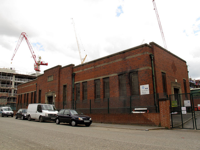
Image: © Stephen Craven Taken: 19 Apr 2014
This building is not listed, perhaps surprisingly given its historical significance. It is a sewage pumping station, lifting water out of what was historically called the Earl Sluice - a river or drainage ditch running from Denmark Hill to the Thames near here - but since the 19th century a public sewer, into the Southern Outfall Sewer running towards Crossness. More detailed history at http://marlowe-shakespeare.blogspot.co.uk/2012/07/getting-body-to-deptford-by-peter-farey.html An overflow takes surplus storm sewage into the Thames nearby, probably using the original course of the river. As of 2014 it is proposed to use the site for a major construction site for a "drop shaft" taking the waters of the Earl Sluice into the Thames Tideway, 30m or more deep under the Thames. The Earl Sluice was historically the boundary between Rotherhithe (Surrey) and Deptford (Kent) ecclesiastical and civil parishes, hence a county boundary. Chilton Grove (foreground) follows the course of the former sluice, and is still on the civil boundary between Southwark and Lewisham boroughs - see Image - but the present ecclesiastical boundary between Holy Trinity, Rotherhithe and St Nicholas & St Luke, Deptford runs behind the pumping station.
Images are licensed for reuse under creativecommons.org/licenses/by-sa/2.0
Image Location
Latitude
51.491853
Longitude
-0.040402