St Faith's church, Farmcote: Stratford monument
Introduction
The photograph on this page of St Faith's church, Farmcote: Stratford monument by Mike Searle as part of the Geograph project.
The Geograph project started in 2005 with the aim of publishing, organising and preserving representative images for every square kilometre of Great Britain, Ireland and the Isle of Man.

There are currently over 7.5m images from over 14,400 individuals and you can help contribute to the project by visiting https://www.geograph.org.uk
St Faith's church, Farmcote: Stratford monument
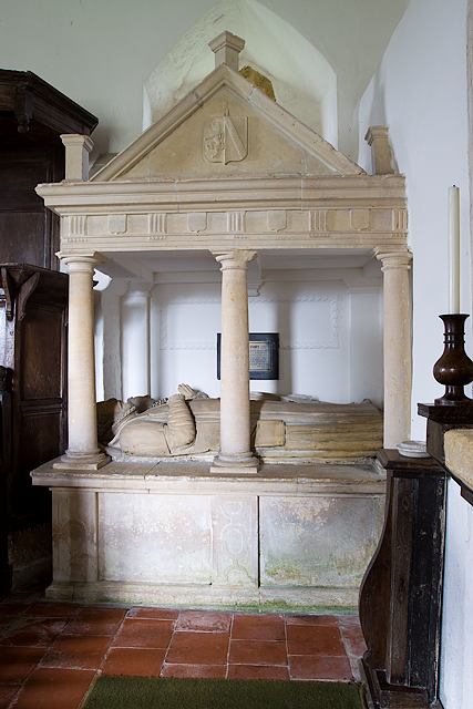
Image: © Mike Searle Taken: 10 Apr 2014
The recumbent civilian stone effigies of William Stratford and his wife Ann Walwyn (†c.1590) on their tomb-chest.
Images are licensed for reuse under creativecommons.org/licenses/by-sa/2.0
Image Location


Leaflet Map data © OpenStreetMap
Latitude
51.959721
Longitude
-1.912199