OSBM Flush Bracket G2006 - Aberystwyth, Spring Gdns
Introduction
The photograph on this page of OSBM Flush Bracket G2006 - Aberystwyth, Spring Gdns by N Scott as part of the Geograph project.
The Geograph project started in 2005 with the aim of publishing, organising and preserving representative images for every square kilometre of Great Britain, Ireland and the Isle of Man.

There are currently over 7.5m images from over 14,400 individuals and you can help contribute to the project by visiting https://www.geograph.org.uk
OSBM Flush Bracket G2006 - Aberystwyth, Spring Gdns
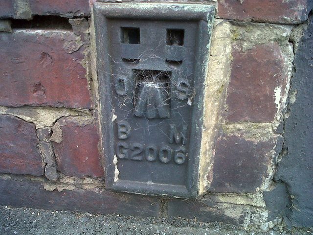
Image: © N Scott Taken: 17 Apr 2014
Ordnance Survey Benchmark (OSBM) used for levelling height above Ordnance Datum (OD). Height (1952): 4.4519m OD (Newlyn). Mark verified by the Ordnance Survey in 1952. Description: FL BR G2006 HO E SIDE RD W FACE NW ANG JUNC SPRING GDNS. 1st Order BM. The bracket was used on the Aberystwyth to Machynlleth line (G012) of the Third Geodetic Levelling of England & Wales in 1952. Abstract G 55: http://discovery.nationalarchives.gov.uk/SearchUI/details?Uri=C11264462 [OS 54/743] Context: Image
Images are licensed for reuse under creativecommons.org/licenses/by-sa/2.0
Image Location
Latitude
52.409312
Longitude
-4.085052