The Staunton Arms
Introduction
The photograph on this page of The Staunton Arms by Alan Murray-Rust as part of the Geograph project.
The Geograph project started in 2005 with the aim of publishing, organising and preserving representative images for every square kilometre of Great Britain, Ireland and the Isle of Man.

There are currently over 7.5m images from over 14,400 individuals and you can help contribute to the project by visiting https://www.geograph.org.uk
The Staunton Arms
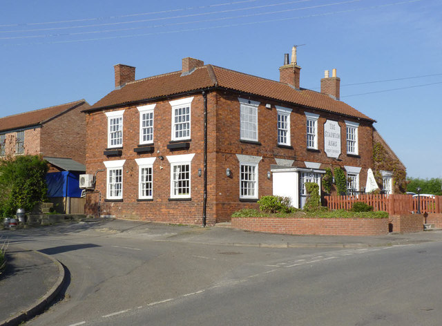
Image: © Alan Murray-Rust Taken: 13 Apr 2014
Early 19th century public house, the exterior very little modernised. Listed Grade II. The listing description indicates that the window to the left of the entrance was once also a blank to match the one above. The building has been largely stripped of creepers since previous pictures on Geograph.
Images are licensed for reuse under creativecommons.org/licenses/by-sa/2.0
Image Location
Latitude
52.984499
Longitude
-0.800883