Disused Public Convenience
Introduction
The photograph on this page of Disused Public Convenience by Martin Addison as part of the Geograph project.
The Geograph project started in 2005 with the aim of publishing, organising and preserving representative images for every square kilometre of Great Britain, Ireland and the Isle of Man.

There are currently over 7.5m images from over 14,400 individuals and you can help contribute to the project by visiting https://www.geograph.org.uk
Disused Public Convenience
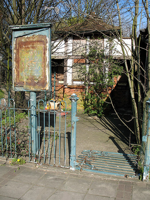
Image: © Martin Addison Taken: 6 Apr 2007
Opposite the council offices in Barnet House is this neglected piece of civic architecture. It must once have been a symbol of civic pride, finished in a half-timbered style. The trees might come in handy if you need to spend a penny! Subsequent to this photo being taken, in September 2009 it was noted that these toilets and the adjacent building have been demolished and the site cleared.
Images are licensed for reuse under creativecommons.org/licenses/by-sa/2.0
Image Location
Latitude
51.629254
Longitude
-0.173918