Horniman Gardens from the Bandstand
Introduction
The photograph on this page of Horniman Gardens from the Bandstand by Marathon as part of the Geograph project.
The Geograph project started in 2005 with the aim of publishing, organising and preserving representative images for every square kilometre of Great Britain, Ireland and the Isle of Man.

There are currently over 7.5m images from over 14,400 individuals and you can help contribute to the project by visiting https://www.geograph.org.uk
Horniman Gardens from the Bandstand
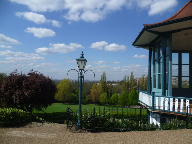
Image: © Marathon Taken: 10 Apr 2014
The view north and west from near the top of Horniman Gardens is one of the best in London as can be seen here from by the bandstand. The very distinct hill top spire (out of the picture here) in line between the chimneys of Battersea Power Station is at Harrow-on-the-Hill, 15 miles away. Occasionally on a very clear day it is possible to see the towers of Windsor Castle, almost exactly due west, 21 miles away. The Bandstand was built in 1903 from a design by Charles Harrison Townsend, and has recently been restored. A much fuller history of Horniman Museum and Gardens can be read at http://www.geograph.org.uk/photo/3929325 The main blot on the landscape and block on the view are the flats at Dawson Heights, seen on the right here. An even better view therefore is on the grass area in front of Dawson Heights as seen here http://www.geograph.org.uk/photo/2635423
Images are licensed for reuse under creativecommons.org/licenses/by-sa/2.0
Image Location
Latitude
51.442299
Longitude
-0.061806