Obelisk Farmhouse and the pedestal of the Umberslade obelisk, Nuthurst
Introduction
The photograph on this page of Obelisk Farmhouse and the pedestal of the Umberslade obelisk, Nuthurst by Robin Stott as part of the Geograph project.
The Geograph project started in 2005 with the aim of publishing, organising and preserving representative images for every square kilometre of Great Britain, Ireland and the Isle of Man.

There are currently over 7.5m images from over 14,400 individuals and you can help contribute to the project by visiting https://www.geograph.org.uk
Obelisk Farmhouse and the pedestal of the Umberslade obelisk, Nuthurst
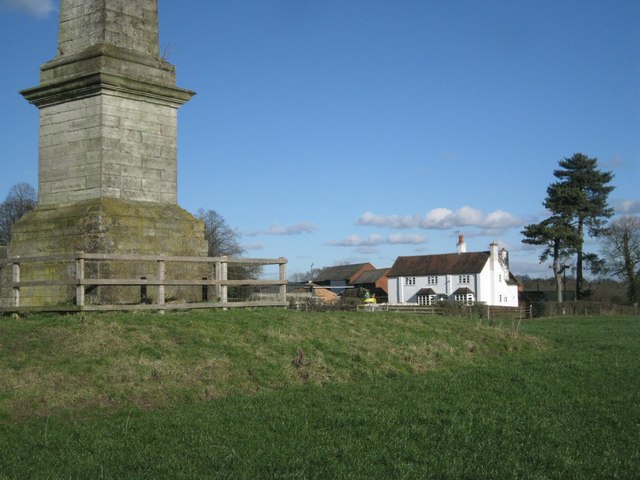
Image: © Robin Stott Taken: 2 Feb 2013
The obelisk is a slender spike of limestone blocks and is over 70 feet tall. It was completed in 1749 for Thomas Archer of Umberslade Hall. It is sited to form an eyecatcher in the view from the east front of the hall. It has received some attention in recent years: in the mid-1990s it was encased in ivy; an elder bush grew from its base http://www.geograph.org.uk/photo/154121 Public access to the Nuthurst obelisk is from Pound House Lane by Obelisk Farm.
Images are licensed for reuse under creativecommons.org/licenses/by-sa/2.0
Image Location
Latitude
52.342825
Longitude
-1.786824