Coventry fire station
Introduction
The photograph on this page of Coventry fire station by E Gammie as part of the Geograph project.
The Geograph project started in 2005 with the aim of publishing, organising and preserving representative images for every square kilometre of Great Britain, Ireland and the Isle of Man.

There are currently over 7.5m images from over 14,400 individuals and you can help contribute to the project by visiting https://www.geograph.org.uk
Coventry fire station
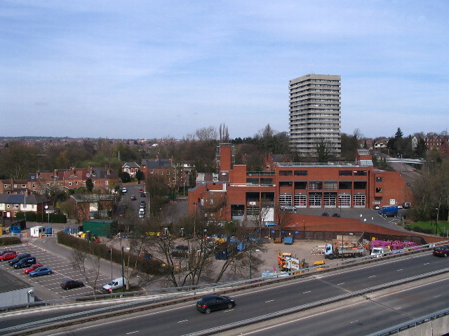
Image: © E Gammie Taken: 6 Apr 2007
This station took over from the old fire station in Hales Street ( Image] ) in 1976. To its left are houses in Middleborough Road, Abbots Lane and Mill Street; to the right, Radford Radial spur. The tower block is Naul's Mill House, the nearby trees are in Naul's Mill Park and the dual carriageway is part of the inner ring road.
Images are licensed for reuse under creativecommons.org/licenses/by-sa/2.0
Image Location
Latitude
52.412153
Longitude
-1.516716