Site of former Akeman Street station, 1991
Introduction
The photograph on this page of Site of former Akeman Street station, 1991 by Ben Brooksbank as part of the Geograph project.
The Geograph project started in 2005 with the aim of publishing, organising and preserving representative images for every square kilometre of Great Britain, Ireland and the Isle of Man.

There are currently over 7.5m images from over 14,400 individuals and you can help contribute to the project by visiting https://www.geograph.org.uk
Site of former Akeman Street station, 1991
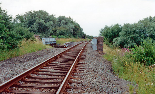
Image: © Ben Brooksbank Taken: 18 Aug 1991
View northward from above the A41 (Akeman Street, Roman road), towards Grendon Underwood Junction, Woodford Halse, Leicester, Nottingham, Sheffield etc. (Cf. Image]). This is the ex-GCR Grendon Underwood Junction - Ashendon Junction link of the 'London Extension' main line, which enabled GC traffic to join the GWR main line from Birmingham to reach London (Marylebone) via High Wycombe. The GC main line was closed 5/9/66, but part of this link remained. (A single track here was evidently in use in 1991 and present-day maps show a line northward from here. Currently (2014) it is under massive development by FCC Greatmoor Energy as a 'waste facility'.
Images are licensed for reuse under creativecommons.org/licenses/by-sa/2.0
Image Location
Latitude
51.857312
Longitude
-0.977443