Gas Street, Newtown
Introduction
The photograph on this page of Gas Street, Newtown by Penny Mayes as part of the Geograph project.
The Geograph project started in 2005 with the aim of publishing, organising and preserving representative images for every square kilometre of Great Britain, Ireland and the Isle of Man.

There are currently over 7.5m images from over 14,400 individuals and you can help contribute to the project by visiting https://www.geograph.org.uk
Gas Street, Newtown
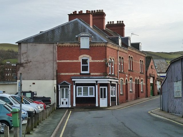
Image: © Penny Mayes Taken: 7 Feb 2014
Buildings in Gas Street showing polychromatic brick decoration often used in the area. The Halfpenny footbridge http://www.geograph.org.uk/photo/914133 is out of shot to the left. Part of Humphreys Garage http://www.geograph.org.uk/photo/1020132 can be seen on the right. The gas works stood on the left (now used as a car park) and behind these buildings next to the river.
Images are licensed for reuse under creativecommons.org/licenses/by-sa/2.0
Image Location
Latitude
52.515167
Longitude
-3.313392