Adelaide Road, London NW3
Introduction
The photograph on this page of Adelaide Road, London NW3 by Kate Jewell as part of the Geograph project.
The Geograph project started in 2005 with the aim of publishing, organising and preserving representative images for every square kilometre of Great Britain, Ireland and the Isle of Man.

There are currently over 7.5m images from over 14,400 individuals and you can help contribute to the project by visiting https://www.geograph.org.uk
Adelaide Road, London NW3
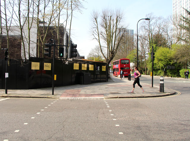
Image: © Kate Jewell Taken: 30 Mar 2014
Looking west from the junction with Primrose Hill Road. The 1970s housing to the left is undergoing a major refurbishment. The large blocks of flats were designed by Dennis Lennon & Partners in consultation with S. A. G. Cook and built in the late 1960s and early 1970s as part of the post war development of this badly bomb damaged area. The nearest to the camera is Dorney, in the centre is Bray and the one in the far distance is Burnham. Out of sight, round the bend in the road is Taplow. Because the free holder of the historical Chalcots Estate in this area was Eton College all four blocks were named after villages near Eton.
Images are licensed for reuse under creativecommons.org/licenses/by-sa/2.0
Image Location
Latitude
51.543479
Longitude
-0.163221