Margett's Pit landfill
Introduction
The photograph on this page of Margett's Pit landfill by Dylan Moore as part of the Geograph project.
The Geograph project started in 2005 with the aim of publishing, organising and preserving representative images for every square kilometre of Great Britain, Ireland and the Isle of Man.

There are currently over 7.5m images from over 14,400 individuals and you can help contribute to the project by visiting https://www.geograph.org.uk
Margett's Pit landfill
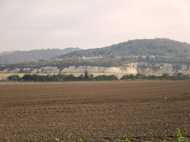
Image: © Dylan Moore Taken: 2 Apr 2014
Margett's Pit is the chalk quarry used by the West Kent cement plant, which operated between 1877 and 1925. For details, see www.cementkilns.co.uk/cement_kiln_west_kent.html and related pages. The pit consisted of Lower Chalk, exposing the Gault Clay at its base, and reaching the Melbourne Rock, which is the base of the Middle Chalk, at its top-most point, visible here. The plant used the chalk from the pit as its sole raw material, blending the high-carbonate material from the upper part with the low-carbonate marl at the base to obtain the desired chemistry. After a long period of abandonment, it is now being land-filled.
Images are licensed for reuse under creativecommons.org/licenses/by-sa/2.0
Image Location


Leaflet Map data © OpenStreetMap
Latitude
51.334759
Longitude
0.47233