Rotherham - Corporation Bridge
Introduction
The photograph on this page of Rotherham - Corporation Bridge by Dave Bevis as part of the Geograph project.
The Geograph project started in 2005 with the aim of publishing, organising and preserving representative images for every square kilometre of Great Britain, Ireland and the Isle of Man.

There are currently over 7.5m images from over 14,400 individuals and you can help contribute to the project by visiting https://www.geograph.org.uk
Rotherham - Corporation Bridge
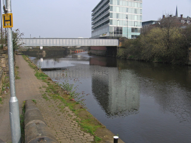
Image: © Dave Bevis Taken: 30 Mar 2014
Photo taken from Don Street. Left to right can be seen: The Don Navigation towpath. The single-span Corporation Bridge carries Main Street over the Don Navigation. Just beyond the bridge, the waterway splits into two. The left branch is the navigable Rotherham Cut and the right branch leads to a weir on the River Don. Between the two branches is Forge Island, currently home to TESCO. The multi-storey building is the Keppel Wharf office block. The spire of Rotherham Minster can just be seen on the right-hand skyline.
Images are licensed for reuse under creativecommons.org/licenses/by-sa/2.0
Image Location
Latitude
53.429281
Longitude
-1.359576