Woodland clearing
Introduction
The photograph on this page of Woodland clearing by Lairich Rig as part of the Geograph project.
The Geograph project started in 2005 with the aim of publishing, organising and preserving representative images for every square kilometre of Great Britain, Ireland and the Isle of Man.

There are currently over 7.5m images from over 14,400 individuals and you can help contribute to the project by visiting https://www.geograph.org.uk
Woodland clearing
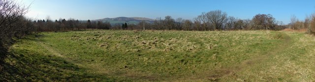
Image: © Lairich Rig Taken: 24 Feb 2014
This particular clearing is depicted on the 1:25000 OS map. It is in Pappert Well Community Woodland. The hills that can be seen left of centre in the background are Carman Hill (Image) and adjacent muirs.
Images are licensed for reuse under creativecommons.org/licenses/by-sa/2.0
Image Location


Leaflet Map data © OpenStreetMap
Latitude
55.982836
Longitude
-4.555851