Limestone outcrop
Introduction
The photograph on this page of Limestone outcrop by Jonathan Wilkins as part of the Geograph project.
The Geograph project started in 2005 with the aim of publishing, organising and preserving representative images for every square kilometre of Great Britain, Ireland and the Isle of Man.

There are currently over 7.5m images from over 14,400 individuals and you can help contribute to the project by visiting https://www.geograph.org.uk
Limestone outcrop
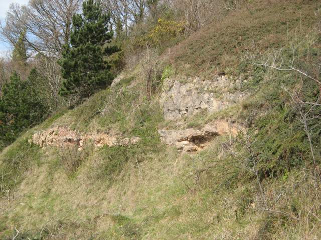
Image: © Jonathan Wilkins Taken: 31 Mar 2014
The prominent hill above the road comprises Carboniferous Limestone, which is seen at outcrop. There is also a horizon of cemented scree, which is formed when water with dissolved calcium carbonate emerges as a spring into overburden such as glacial deposits. The water precipitates carbonate which binds together the loose fragments to make a compact and durable deposit. The hillside is notably colonised by Cotoneaster horizontalis, which is invasive and detrimental to this limestone habitat.
Images are licensed for reuse under creativecommons.org/licenses/by-sa/2.0
Image Location
Latitude
53.318431
Longitude
-3.777201