Former locks on river Foss Navigation
Introduction
The photograph on this page of Former locks on river Foss Navigation by Christopher Hall as part of the Geograph project.
The Geograph project started in 2005 with the aim of publishing, organising and preserving representative images for every square kilometre of Great Britain, Ireland and the Isle of Man.

There are currently over 7.5m images from over 14,400 individuals and you can help contribute to the project by visiting https://www.geograph.org.uk
Former locks on river Foss Navigation
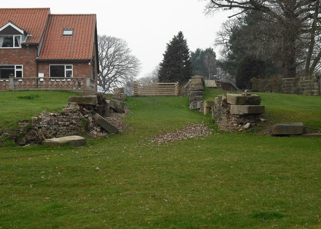
Image: © Christopher Hall Taken: 30 Mar 2014
This staircase of two former locks is in the garden of Lock House. They were built for the River Foss Navigation in the early years of the 19th century. At this point the navigation has made a right angled turn away from the river as it was intended to build a new cut from this point
Images are licensed for reuse under creativecommons.org/licenses/by-sa/2.0
Image Location
Latitude
54.048234
Longitude
-1.016989