Flaybrick Water Tower
Introduction
The photograph on this page of Flaybrick Water Tower by Mr M Evison as part of the Geograph project.
The Geograph project started in 2005 with the aim of publishing, organising and preserving representative images for every square kilometre of Great Britain, Ireland and the Isle of Man.

There are currently over 7.5m images from over 14,400 individuals and you can help contribute to the project by visiting https://www.geograph.org.uk
Flaybrick Water Tower
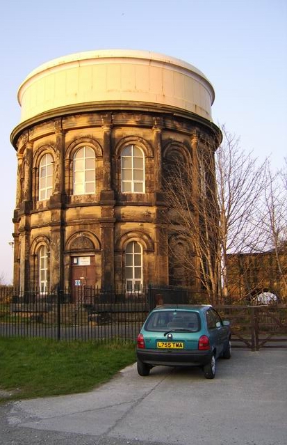
Image: © Mr M Evison Taken: 1 Apr 2007
The water piped into this water tower travels from Alwen reservoir in Wales by underground aqueduct http://www.geograph.org.uk/photo/10488
Images are licensed for reuse under creativecommons.org/licenses/by-sa/2.0
Image Location


Leaflet Map data © OpenStreetMap
Latitude
53.393093
Longitude
-3.063117