Burgess Park, manmade knoll and bank slide
Introduction
The photograph on this page of Burgess Park, manmade knoll and bank slide by Robin Stott as part of the Geograph project.
The Geograph project started in 2005 with the aim of publishing, organising and preserving representative images for every square kilometre of Great Britain, Ireland and the Isle of Man.

There are currently over 7.5m images from over 14,400 individuals and you can help contribute to the project by visiting https://www.geograph.org.uk
Burgess Park, manmade knoll and bank slide
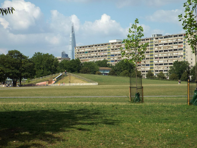
Image: © Robin Stott Taken: 25 Aug 2013
One of the geometric knolls on the north side of the park has a long path up its ridge with a slide down the short slope into the new play area. In the background is a slab of the Aylesbury estate and, beyond it, the Shard near London Bridge station.
Images are licensed for reuse under creativecommons.org/licenses/by-sa/2.0
Image Location
Latitude
51.484023
Longitude
-0.083515