Level-crossing at site of former Gwinear Road station, 1995
Introduction
The photograph on this page of Level-crossing at site of former Gwinear Road station, 1995 by Ben Brooksbank as part of the Geograph project.
The Geograph project started in 2005 with the aim of publishing, organising and preserving representative images for every square kilometre of Great Britain, Ireland and the Isle of Man.

There are currently over 7.5m images from over 14,400 individuals and you can help contribute to the project by visiting https://www.geograph.org.uk
Level-crossing at site of former Gwinear Road station, 1995
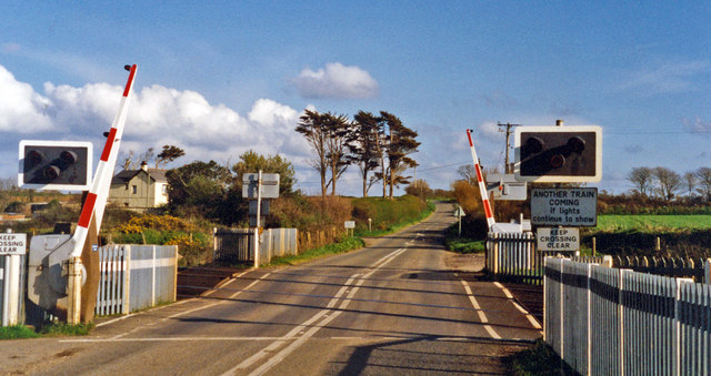
Image: © Ben Brooksbank Taken: 23 Apr 1995
View SE, across ex-GWR Plymouth - Truro (to left)- (to right) Penzance main line, junction of branch to Helston. The station had been to the right and was closed (along with the service to Helston) to passengers 5/10/64, but the branch remained open for goods until 3/7/67.
Images are licensed for reuse under creativecommons.org/licenses/by-sa/2.0
Image Location
Latitude
50.197096
Longitude
-5.346663