Brimmon Lane 1
Introduction
The photograph on this page of Brimmon Lane 1 by Jonathan Wilkins as part of the Geograph project.
The Geograph project started in 2005 with the aim of publishing, organising and preserving representative images for every square kilometre of Great Britain, Ireland and the Isle of Man.

There are currently over 7.5m images from over 14,400 individuals and you can help contribute to the project by visiting https://www.geograph.org.uk
Brimmon Lane 1
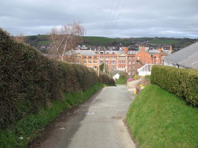
Image: © Jonathan Wilkins Taken: 17 Mar 2014
Now reduced to a footpath linking Heol Treowen with the lower town, this lane has its origin in an older route to farms on the hill to the south of the town (see Image). There is also access to adjacent houses by car, but not as a through route. The Royal Welsh Warehouse can be seen in the valley below.
Images are licensed for reuse under creativecommons.org/licenses/by-sa/2.0
Image Location
Latitude
52.511972
Longitude
-3.309613