The Manchester, Bolton and Bury Canal at Salford
Introduction
The photograph on this page of The Manchester, Bolton and Bury Canal at Salford by David Dixon as part of the Geograph project.
The Geograph project started in 2005 with the aim of publishing, organising and preserving representative images for every square kilometre of Great Britain, Ireland and the Isle of Man.

There are currently over 7.5m images from over 14,400 individuals and you can help contribute to the project by visiting https://www.geograph.org.uk
The Manchester, Bolton and Bury Canal at Salford
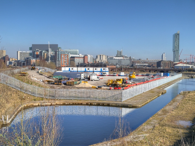
Image: © David Dixon Taken: 11 Mar 2014
Part of the recently restored section of canal to the west of its junction with the River Irwell. Looking towards Manchester with the city's skyline, including the distinctive Beetham Tower, visible in the background.
Images are licensed for reuse under creativecommons.org/licenses/by-sa/2.0
Image Location
Latitude
53.480499
Longitude
-2.264409