Manchester, Bolton and Bury Canal
Introduction
The photograph on this page of Manchester, Bolton and Bury Canal by David Dixon as part of the Geograph project.
The Geograph project started in 2005 with the aim of publishing, organising and preserving representative images for every square kilometre of Great Britain, Ireland and the Isle of Man.

There are currently over 7.5m images from over 14,400 individuals and you can help contribute to the project by visiting https://www.geograph.org.uk
Manchester, Bolton and Bury Canal
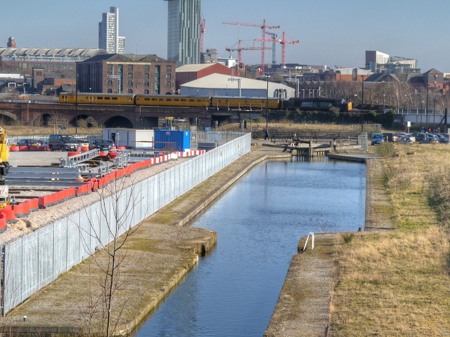
Image: © David Dixon Taken: 11 Mar 2014
Part of the recently restored section of canal to the west of its junction with the River Irwell. Looking towards the railway viaduct alongside the A6042. The red-brick building behind the viaduct is Image I have been informed by John Webb that the unusual yellow-coloured train is one of Network Rail's measurement trains that tour the network examining the track at regular intervals.
Images are licensed for reuse under creativecommons.org/licenses/by-sa/2.0
Image Location
Latitude
53.479604
Longitude
-2.262595