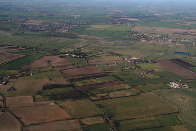
Washingborough Fen: aerial 2014
Introduction
The photograph on this page of Washingborough Fen: aerial 2014 by Chris as part of the Geograph project.
The Geograph project started in 2005 with the aim of publishing, organising and preserving representative images for every square kilometre of Great Britain, Ireland and the Isle of Man.
There are currently over 7.5m images from over 14,400 individuals and you can help contribute to the project by visiting https://www.geograph.org.uk

Image: © Chris Taken: 11 Mar 2014
Of all the shots I took on this glorious day I think this is my favourite, because there is so much of interest in it. The view is northwards across the River Witham, flanked by the North and South Delph. Villages of Cherry Willingham and Fiskerton left and right. On the near side of the river, top left are the drains called The Longstongs, running into Longstongs Delph, which runs alongside South Delph. At the near end of the Longstongs, behind the line of houses and road is the course of the disused Car Dyke (the Roman waterway, not the place you dyke your car on a frosty night!). Left of the flooded field, at the edge of the South Delph, is a pumping station. The big farm left of the reservoir is Ings Farm, on Five Mile Lane, which leads to a footbridge over the Witham and the adjacent delphs. The Car Dyke continues, as a functioning drain along the near side of the road (B1190) running diagonally from Ings Farm to the white on the right.

