Green Lane, Bank Top, Southowram
Introduction
The photograph on this page of Green Lane, Bank Top, Southowram by Phil Champion as part of the Geograph project.
The Geograph project started in 2005 with the aim of publishing, organising and preserving representative images for every square kilometre of Great Britain, Ireland and the Isle of Man.

There are currently over 7.5m images from over 14,400 individuals and you can help contribute to the project by visiting https://www.geograph.org.uk
Green Lane, Bank Top, Southowram
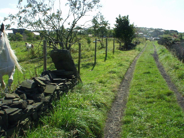
Image: © Phil Champion Taken: 10 Sep 2004
View south along Green Lane (footpath Halifax 589) towards Bank Top. The area to the left of the picture has been extensively quarried and backfilled during the twentieth century. Evidence of this activity can clearly been seen in the humps and hollows on the field. Limited sandstone extraction still takes place at Beacon Lodge Quarry, just out of shot. Halifax town centre is less than a mile away down the steep hillside to the west.
Images are licensed for reuse under creativecommons.org/licenses/by-sa/2.0
Image Location


Leaflet Map data © OpenStreetMap
Latitude
53.719061
Longitude
-1.845247