Threepenny bit house
Introduction
The photograph on this page of Threepenny bit house by Richard Croft as part of the Geograph project.
The Geograph project started in 2005 with the aim of publishing, organising and preserving representative images for every square kilometre of Great Britain, Ireland and the Isle of Man.

There are currently over 7.5m images from over 14,400 individuals and you can help contribute to the project by visiting https://www.geograph.org.uk
Threepenny bit house
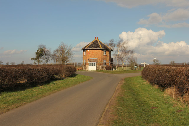
Image: © Richard Croft Taken: 1 Mar 2014
Six-sided former toll house on Littleborough Road, known locally as 'Threepenny bit house' .... an erroneous reference to the pre-decimal threepenny coin which had 12 sides. Now called Littleborough Cottage. It was built by the Retford & Littleborough Turnpike Trust c1825 for the turnpike road that ran from Spittle Hill in Retford to the chain ferry across the River Trent at Littleborough. The original plan to build a bridge at Littleborough was abandoned due to engineering difficulties and expansion of the railway network and opening of the bridges at Dunham and Gainsborough brought about the demise of Littleborough Ferry which closed in 1910.
Images are licensed for reuse under creativecommons.org/licenses/by-sa/2.0
Image Location


Leaflet Map data © OpenStreetMap
Latitude
53.338271
Longitude
-0.777917