Tour de France 2014 Route - Oughtibridge - 1
Introduction
The photograph on this page of Tour de France 2014 Route - Oughtibridge - 1 by Terry Robinson as part of the Geograph project.
The Geograph project started in 2005 with the aim of publishing, organising and preserving representative images for every square kilometre of Great Britain, Ireland and the Isle of Man.

There are currently over 7.5m images from over 14,400 individuals and you can help contribute to the project by visiting https://www.geograph.org.uk
Tour de France 2014 Route - Oughtibridge - 1
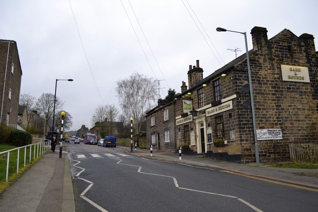
Image: © Terry Robinson Taken: 8 Mar 2014
This view shows the 'bottom end' of Church Street with the Hare and Hounds Pub on the right, sure to be a popular spot to watch the 'Race' … for Church Street's 'top end' … see … Image The riders will approach from the top of the picture and at this point will be braking hard in order to negotiate Bridge Hill, then the Bridge, and then the start of the Cote d'Oughtibridge climb. For more views of this area … see … Image Image Image Image Image Image Image Image Image
Images are licensed for reuse under creativecommons.org/licenses/by-sa/2.0
Image Location
Latitude
53.435775
Longitude
-1.54026