Out Elmstead Lane
Introduction
The photograph on this page of Out Elmstead Lane by John Baker as part of the Geograph project.
The Geograph project started in 2005 with the aim of publishing, organising and preserving representative images for every square kilometre of Great Britain, Ireland and the Isle of Man.

There are currently over 7.5m images from over 14,400 individuals and you can help contribute to the project by visiting https://www.geograph.org.uk
Out Elmstead Lane
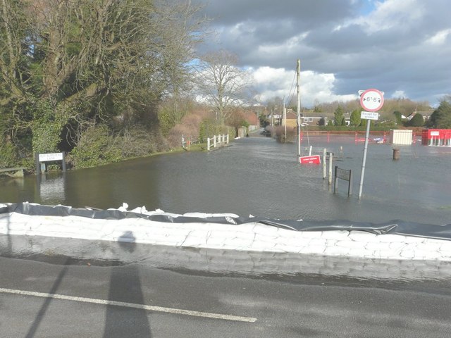
Image: © John Baker Taken: 13 Feb 2014
A line of sandbags has been placed across the entrance to the lane to prevent the flooding of Valley Road by the Nail Bourne, which has burst its banks. A ford is marked on the map and its location is seen here by the white railing on the left.
Images are licensed for reuse under creativecommons.org/licenses/by-sa/2.0
Image Location
Latitude
51.214148
Longitude
1.153231