Civil threat
Introduction
The photograph on this page of Civil threat by Neil Owen as part of the Geograph project.
The Geograph project started in 2005 with the aim of publishing, organising and preserving representative images for every square kilometre of Great Britain, Ireland and the Isle of Man.

There are currently over 7.5m images from over 14,400 individuals and you can help contribute to the project by visiting https://www.geograph.org.uk
Civil threat
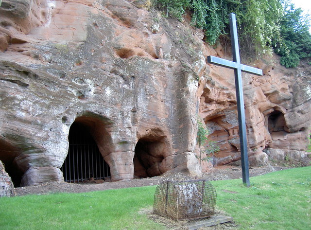
Image: © Neil Owen Taken: 21 Jul 2010
The many scrapings and tunnels along the Underhill part of Bridgnorth, part of the efforts to seize the castle above in the Civil War. See Image] for the Colonel's cave.
Images are licensed for reuse under creativecommons.org/licenses/by-sa/2.0
Image Location


Leaflet Map data © OpenStreetMap
Latitude
52.532597
Longitude
-2.417737