Leadgate Maze viewing platform
Introduction
The photograph on this page of Leadgate Maze viewing platform by Oliver Dixon as part of the Geograph project.
The Geograph project started in 2005 with the aim of publishing, organising and preserving representative images for every square kilometre of Great Britain, Ireland and the Isle of Man.

There are currently over 7.5m images from over 14,400 individuals and you can help contribute to the project by visiting https://www.geograph.org.uk
Leadgate Maze viewing platform
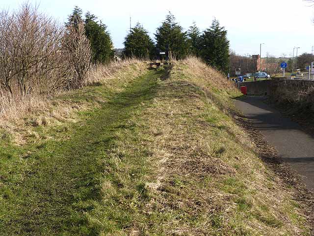
Image: © Oliver Dixon Taken: 28 Feb 2014
The Consett and Sunderland path (part of the famous C2C cycle route, National Cycle Network route 7) follows the line of an old railway from Stanhope Moor down to Washington. At this point the embankment is cut by road construction around the roundabout at the eastern end of the Leadgate By-pass (A692) ("Jolly Drovers" roundabout). The structure at the end of the embankment is supposed to be a "viewing point" for the Leadgate Maze NZ1352 : The Jolly Drovers Maze at Leadgate on the other side of the roundabout. Unfortunately, it no longer serves this purpose as the view has been very effectively blocked by a row of fast-growing leylandii trees which have been planted along the west side of the carpark of the "Jolly Drovers".
Images are licensed for reuse under creativecommons.org/licenses/by-sa/2.0
Image Location


Leaflet Map data © OpenStreetMap
Latitude
54.862161
Longitude
-1.794639