Daffodils in Mile End Park
Introduction
The photograph on this page of Daffodils in Mile End Park by Marathon as part of the Geograph project.
The Geograph project started in 2005 with the aim of publishing, organising and preserving representative images for every square kilometre of Great Britain, Ireland and the Isle of Man.

There are currently over 7.5m images from over 14,400 individuals and you can help contribute to the project by visiting https://www.geograph.org.uk
Daffodils in Mile End Park
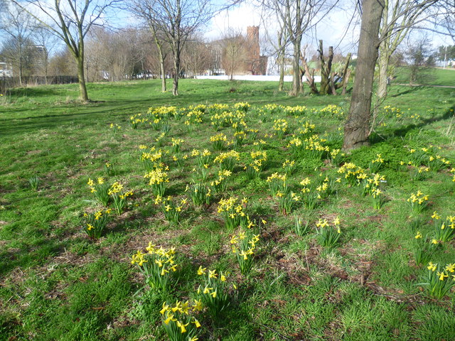
Image: © Marathon Taken: 26 Feb 2014
The 1943 County of London Plan envisaged that a strip of open space could be created along the eastern bank of the Regent's Canal to connect Victoria Park with the River Thames. Mile End Park was developed over a number of years by demolishing substandard housing and landscaping the surrounding areas. The first major section opened in 1952. In some areas the land has been gently mounded to provide a contrast with the typical flat terrain of the park. In this view, the green bridge over Mile End Road is on the extreme right, with the tower of the Roman Catholic Church of The Guardian Angels in the middle on the other side of Mile End Road. Although much was cleared away to create the park, features which were kept, like the church, helped to give a link to the past and provide additional interest in the largely flat landscape. The green bridge is a pedestrian bridge opened in July 1999. It was built over the Mile End Road which bisects the park - see http://www.geograph.org.uk/photo/3867632 The white band in the middle of the photograph is a water feature - see http://www.geograph.org.uk/photo/3866551
Images are licensed for reuse under creativecommons.org/licenses/by-sa/2.0
Image Location
Latitude
51.523434
Longitude
-0.036019