Lowdham, Notts.
Introduction
The photograph on this page of Lowdham, Notts. by David Hallam-Jones as part of the Geograph project.
The Geograph project started in 2005 with the aim of publishing, organising and preserving representative images for every square kilometre of Great Britain, Ireland and the Isle of Man.

There are currently over 7.5m images from over 14,400 individuals and you can help contribute to the project by visiting https://www.geograph.org.uk
Lowdham, Notts.
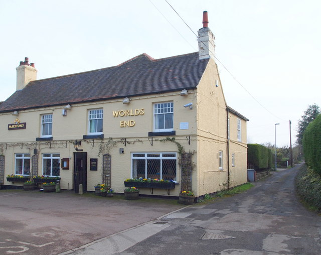
Image: © David Hallam-Jones Taken: 28 Feb 2014
Although "The World's End" pub sits on Plough Lane and appears to blend into this semi-rural setting its large car park also spills out - on its other side - onto the A6097 (the Epperstone By-Pass) ensuring that it remains a fairly busy establishment. It dates back to the 1800s and used to be called "The Plough". It was Bill Grice however, the landlord in the 1980s, who decided to change its name to "The World’s End". A blacksmith’s forge once existed opposite the front door of "The Plough". The T-shaped end to this lane ends in two cul-de-sacs. Behind the photographer is its junction with Ton Lane.
Images are licensed for reuse under creativecommons.org/licenses/by-sa/2.0
Image Location
Latitude
53.011401
Longitude
-1.008361