Lowdham, Notts.
Introduction
The photograph on this page of Lowdham, Notts. by David Hallam-Jones as part of the Geograph project.
The Geograph project started in 2005 with the aim of publishing, organising and preserving representative images for every square kilometre of Great Britain, Ireland and the Isle of Man.

There are currently over 7.5m images from over 14,400 individuals and you can help contribute to the project by visiting https://www.geograph.org.uk
Lowdham, Notts.
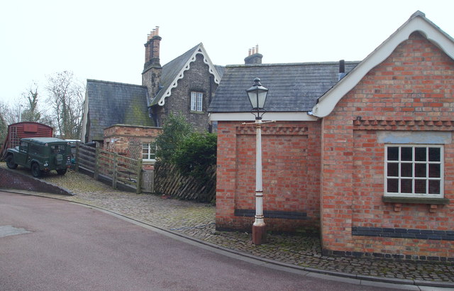
Image: © David Hallam-Jones Taken: 28 Feb 2014
The dark-brick building on this newly developed cul-de-sac, now known as The Sidings, was the combined station building (ticket office etc.) and the station master's house. This older building passed into private ownership in 1990. The single-storey red brick building appears to be a newer addition and was perhaps (?) created in this style in order to achieve planning permission? The ramp seems likely to have served previously as a staithe for loading coal from wagons onto coal lorries.
Images are licensed for reuse under creativecommons.org/licenses/by-sa/2.0
Image Location
Latitude
53.006464
Longitude
-0.998489