Lowdham, Notts.
Introduction
The photograph on this page of Lowdham, Notts. by David Hallam-Jones as part of the Geograph project.
The Geograph project started in 2005 with the aim of publishing, organising and preserving representative images for every square kilometre of Great Britain, Ireland and the Isle of Man.

There are currently over 7.5m images from over 14,400 individuals and you can help contribute to the project by visiting https://www.geograph.org.uk
Lowdham, Notts.
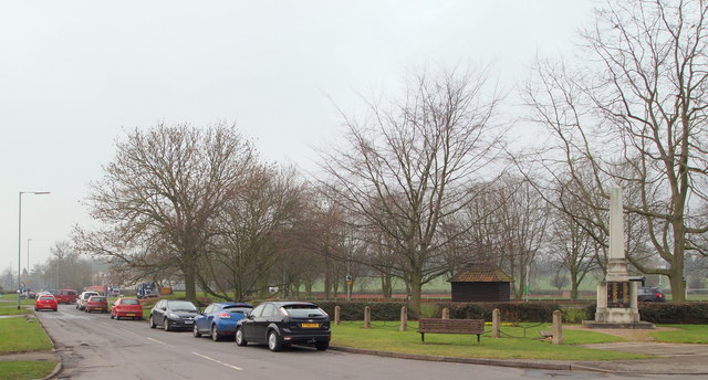
Image: © David Hallam-Jones Taken: 28 Feb 2014
This is Nottingham Road, the initial few metres of its namesake (i.e. the A612), that acts here as a short cut between Station Road - behind the photographer - and the point ahead where the main road between Southwell-Nottingham and the Epperstone By-Pass (A6097) meet at a busy roundabout. It is residential on the side that faces the war memorial seen here. The bus shelter provides protection for passengers waiting for Southwell to Nottingham buses travelling in the direction of Nottingham. Opposite the bus shelter, on the other side of the road, is Lowdham's recreation ground.
Images are licensed for reuse under creativecommons.org/licenses/by-sa/2.0
Image Location
Latitude
53.008552
Longitude
-1.000975