Surtees Bridge
Introduction
The photograph on this page of Surtees Bridge by Mick Garratt as part of the Geograph project.
The Geograph project started in 2005 with the aim of publishing, organising and preserving representative images for every square kilometre of Great Britain, Ireland and the Isle of Man.

There are currently over 7.5m images from over 14,400 individuals and you can help contribute to the project by visiting https://www.geograph.org.uk
Surtees Bridge
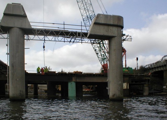
Image: © Mick Garratt Taken: 1 Apr 2007
Construction of the new Surtees Bridge over the Tees is continuing. The new bridge carrying two lanes is opened and here the old bridge has been cut away and removed. It looks as though the old piers will be reused. Why "Surtees"? There are two theories. Firstly it is named after the Surtees family, lords of the manor of Dinsdale in medieval times. Alternatively it's a corruption of the french "sur Tees" meaning on the Tees.
Images are licensed for reuse under creativecommons.org/licenses/by-sa/2.0
Image Location
Latitude
54.554382
Longitude
-1.311159