28 and 26 Kelsall Road, Burley, Leeds, 1981
Introduction
The photograph on this page of 28 and 26 Kelsall Road, Burley, Leeds, 1981 by William Starkey as part of the Geograph project.
The Geograph project started in 2005 with the aim of publishing, organising and preserving representative images for every square kilometre of Great Britain, Ireland and the Isle of Man.

There are currently over 7.5m images from over 14,400 individuals and you can help contribute to the project by visiting https://www.geograph.org.uk
28 and 26 Kelsall Road, Burley, Leeds, 1981
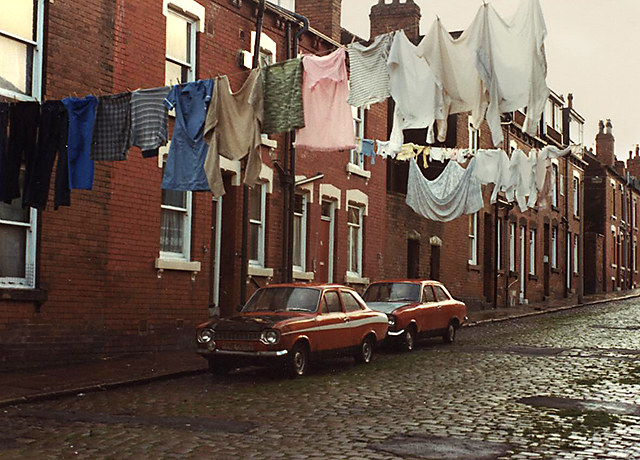
Image: © William Starkey Taken: Unknown
Back to back terraced housing on Kelsall Road in the Burley area of Leeds. Image taken in 1981. Number 28 is the house on the left nearest the camera with number 26 next door. The houses on the back of this row have since been demolished, but this side survived. The outdoor privies have been demolished and are now a community garden with storage space for bins.
Images are licensed for reuse under creativecommons.org/licenses/by-sa/2.0
Image Location
Latitude
53.806205
Longitude
-1.570385