Redevelopment at the former Buckland Paper Mill, Crabble Hill
Introduction
The photograph on this page of Redevelopment at the former Buckland Paper Mill, Crabble Hill by John Baker as part of the Geograph project.
The Geograph project started in 2005 with the aim of publishing, organising and preserving representative images for every square kilometre of Great Britain, Ireland and the Isle of Man.

There are currently over 7.5m images from over 14,400 individuals and you can help contribute to the project by visiting https://www.geograph.org.uk
Redevelopment at the former Buckland Paper Mill, Crabble Hill
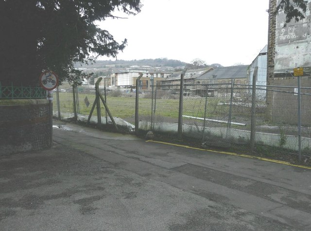
Image: © John Baker Taken: 31 Jan 2014
Seen from Crabble Meadows. Planning permission has been granted by Dover District Council under application number DOV/06/01455 for a “mixed use development (new build and change of use) comprising detailed proposals (phase 1) for 141 residential units, retail (A1), offices (B1), café/restaurant bar (A4/A5), community huts (LD1/B1), open space, landscaping, parking and access and outline proposals (phases 1A, 2, 3 & 4) for up to 265 residential units, 80 bed nursing home and access - all other matters (lay out, scale, appearance and landscaping) reserved . The frontage of the building in Crabble Hill can be seen in Image
Images are licensed for reuse under creativecommons.org/licenses/by-sa/2.0
Image Location
Latitude
51.137839
Longitude
1.29458