River wall at Harlinger Street
Introduction
The photograph on this page of River wall at Harlinger Street by Stephen Craven as part of the Geograph project.
The Geograph project started in 2005 with the aim of publishing, organising and preserving representative images for every square kilometre of Great Britain, Ireland and the Isle of Man.

There are currently over 7.5m images from over 14,400 individuals and you can help contribute to the project by visiting https://www.geograph.org.uk
River wall at Harlinger Street
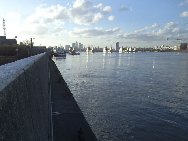
Image: © Stephen Craven Taken: 16 Feb 2014
The upper level here is the Thames flood defences, equivalent to the top of the Thames barrier gates; the lower level is the original river wall. The photo taken roughly at mid-tide.
Images are licensed for reuse under creativecommons.org/licenses/by-sa/2.0
Image Location
Latitude
51.495055
Longitude
0.045887