Red Hill, Redhill, NG5, Notts.
Introduction
The photograph on this page of Red Hill, Redhill, NG5, Notts. by David Hallam-Jones as part of the Geograph project.
The Geograph project started in 2005 with the aim of publishing, organising and preserving representative images for every square kilometre of Great Britain, Ireland and the Isle of Man.

There are currently over 7.5m images from over 14,400 individuals and you can help contribute to the project by visiting https://www.geograph.org.uk
Red Hill, Redhill, NG5, Notts.
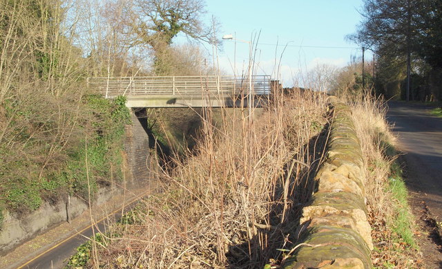
Image: © David Hallam-Jones Taken: 16 Feb 2014
The hamlet of Red Hill in Redhill sits on the crown of this hill. This short branch road - that runs parallel with the A60 (Nottingham-Mansfield Road) seen here on the left - serves a row of long-established and expensive houses ahead (on the right) and another row of equally long-established and expensive houses on the other side of the bridge. The Leapool allotment site (that is owned by the Borough of Gedling) is also situated on the left-hand side of this bridge, as is the Redhill covered reservoir (managed by the Severn Trent Company). In 1218 this stretch of the former Old North Road (London to York, via Nottingham) was referred to as the "rubeam rodam" (the red road)", according to the Revs. R.W. King & J. Russell (eds), in A History of Arnold (1913). The cutting that allows for the passage of the Nottingham to Mansfield Road was carved out in 1787. A stone arch carrying residential and agricultural traffic over this cutting collapsed in 1890 and was subsequently replaced a replacement metal bridge paid for jointly by the local authority and local landowners. In 1928 the cutting was widened to allow for road widening and this bridge was installed.
Images are licensed for reuse under creativecommons.org/licenses/by-sa/2.0
Image Location
Latitude
53.017305
Longitude
-1.131208