Lesbury Pant
Introduction
The photograph on this page of Lesbury Pant by Russel Wills as part of the Geograph project.
The Geograph project started in 2005 with the aim of publishing, organising and preserving representative images for every square kilometre of Great Britain, Ireland and the Isle of Man.

There are currently over 7.5m images from over 14,400 individuals and you can help contribute to the project by visiting https://www.geograph.org.uk
Lesbury Pant
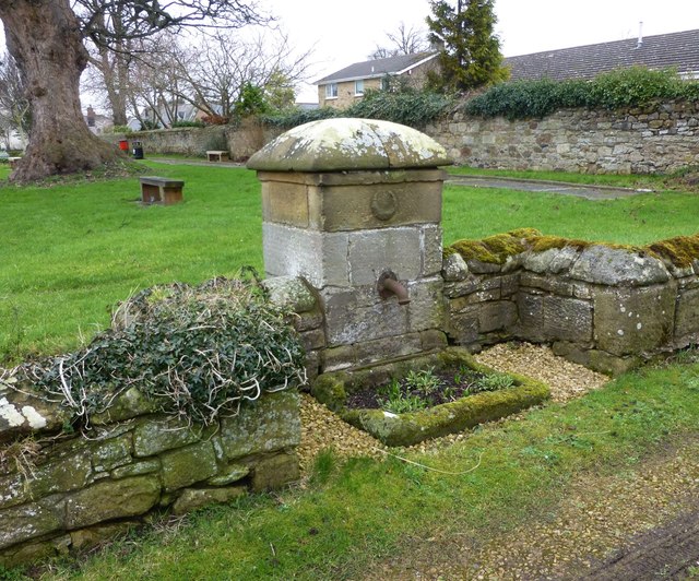
Image: © Russel Wills Taken: 14 Feb 2014
English Heritage - 'Pant, mid-C19. Squared stone with cast-iron spout. Small square structure with plinth, relief-carved Percy crescent above spout, and low domed top. Worn stone trough sunk into ground.'
Images are licensed for reuse under creativecommons.org/licenses/by-sa/2.0
Image Location
Latitude
55.39833
Longitude
-1.630982