Salem, Robertstown, Aberdare
Introduction
The photograph on this page of Salem, Robertstown, Aberdare by Jaggery as part of the Geograph project.
The Geograph project started in 2005 with the aim of publishing, organising and preserving representative images for every square kilometre of Great Britain, Ireland and the Isle of Man.

There are currently over 7.5m images from over 14,400 individuals and you can help contribute to the project by visiting https://www.geograph.org.uk
Salem, Robertstown, Aberdare
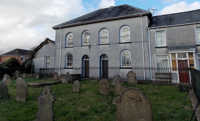
Image: © Jaggery Taken: 4 Feb 2014
Viewed from Bridge Street in early February 2014. There was no name sign here, and the building is not shown on current maps as a place of worship, so it seems that Salem chapel is now in residential use.
Images are licensed for reuse under creativecommons.org/licenses/by-sa/2.0
Image Location
Latitude
51.720496
Longitude
-3.446731