Heygate Estate, preparing for demolition
Introduction
The photograph on this page of Heygate Estate, preparing for demolition by Malc McDonald as part of the Geograph project.
The Geograph project started in 2005 with the aim of publishing, organising and preserving representative images for every square kilometre of Great Britain, Ireland and the Isle of Man.

There are currently over 7.5m images from over 14,400 individuals and you can help contribute to the project by visiting https://www.geograph.org.uk
Heygate Estate, preparing for demolition
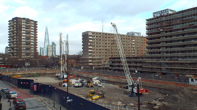
Image: © Malc McDonald Taken: 9 Feb 2014
The derelict blocks of flats in the right half of this image are part of the Heygate Estate. The last resident had left the estate three months before this image was taken in early 2014. The derelict tower blocks will soon be demolished. In their place, new streets and housing are due to be built. Visible towards the left of the image is The Shard. At the time this image was taken, The Shard was the tallest building in the European Union.
Images are licensed for reuse under creativecommons.org/licenses/by-sa/2.0
Image Location
Latitude
51.4937
Longitude
-0.097947