Fort Victoria, Sconce Point, Isle of Wight
Introduction
The photograph on this page of Fort Victoria, Sconce Point, Isle of Wight by Terry Robinson as part of the Geograph project.
The Geograph project started in 2005 with the aim of publishing, organising and preserving representative images for every square kilometre of Great Britain, Ireland and the Isle of Man.

There are currently over 7.5m images from over 14,400 individuals and you can help contribute to the project by visiting https://www.geograph.org.uk
Fort Victoria, Sconce Point, Isle of Wight
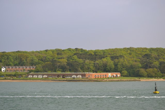
Image: © Terry Robinson Taken: 20 May 2013
Fort Victoria, built in the 1850s, was a single tier battery with defensible barracks at Sconce Point, West of Yarmouth on the Isle of Wight. After it (soon) became redundant as a practical fort, it was used as a submarine mining centre and as a military training area. There were large barrack blocks behind the fort, where the modern houses can be seen, but these were demolished in 1969, leaving just the sea-facing casemates. The casemates have been adapted into a tourist attraction and include a marine aquarium, a planetarium, a café, a model railway display and the Underwater Archaeology Centre See this view submitted by Graham Horn … Image Sconce Point Buoy can (just) be seen on the right … see … Image
Images are licensed for reuse under creativecommons.org/licenses/by-sa/2.0
Image Location
Latitude
50.706587
Longitude
-1.52185