Saltmarshes at Mundon Creek
Introduction
The photograph on this page of Saltmarshes at Mundon Creek by Lynda Poulter as part of the Geograph project.
The Geograph project started in 2005 with the aim of publishing, organising and preserving representative images for every square kilometre of Great Britain, Ireland and the Isle of Man.

There are currently over 7.5m images from over 14,400 individuals and you can help contribute to the project by visiting https://www.geograph.org.uk
Saltmarshes at Mundon Creek
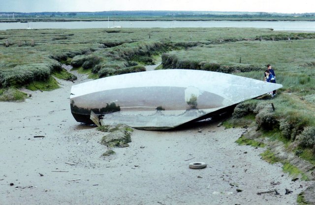
Image: © Lynda Poulter Taken: 1 Apr 2007
The hull of this boat has lain in this spot on the saltmarsh for many years. It must have been damaged before it was built. The area is used by many wading birds for feeding.
Images are licensed for reuse under creativecommons.org/licenses/by-sa/2.0
Image Location
Latitude
51.690611
Longitude
0.755742