Stand, Seaview, Belfast
Introduction
The photograph on this page of Stand, Seaview, Belfast by Albert Bridge as part of the Geograph project.
The Geograph project started in 2005 with the aim of publishing, organising and preserving representative images for every square kilometre of Great Britain, Ireland and the Isle of Man.

There are currently over 7.5m images from over 14,400 individuals and you can help contribute to the project by visiting https://www.geograph.org.uk
Stand, Seaview, Belfast
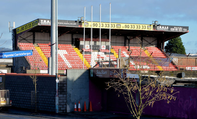
Image: © Albert Bridge Taken: 6 Feb 2014
The Main Stand, on the northern side of Seaview Image, seen from the Shore Road. The history of the ground is explained in this link http://en.wikipedia.org/wiki/Seaview_(football_ground). Irish League attendances have been declining over the last 40+ years. Many ground fell into a state of disrepair. Grants are now available for modernisation. Some further reading is available here http://www.skyscrapercity.com/showthread.php?s=1267e30bc733817223d83b72b8265830&t=1131659.
Images are licensed for reuse under creativecommons.org/licenses/by-sa/2.0
Image Location
Latitude
54.624591
Longitude
-5.922184