Pont Llangwarren
Introduction
The photograph on this page of Pont Llangwarren by Natasha Ceridwen de Chroustchoff as part of the Geograph project.
The Geograph project started in 2005 with the aim of publishing, organising and preserving representative images for every square kilometre of Great Britain, Ireland and the Isle of Man.

There are currently over 7.5m images from over 14,400 individuals and you can help contribute to the project by visiting https://www.geograph.org.uk
Pont Llangwarren
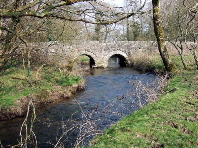
Image: © Natasha Ceridwen de Chroustchoff Taken: 31 Mar 2007
The Pevsner Architectural Guide describes this C18 bridge as having four arches. Well, I'm not so sure... maybe two have become earthed up. I should have looked more closely. It spans the Afon Cleddau near Llangwarren House.
Images are licensed for reuse under creativecommons.org/licenses/by-sa/2.0
Image Location


Leaflet Map data © OpenStreetMap
Latitude
51.940889
Longitude
-5.012376