Building site, Mill Road
Introduction
The photograph on this page of Building site, Mill Road by John Baker as part of the Geograph project.
The Geograph project started in 2005 with the aim of publishing, organising and preserving representative images for every square kilometre of Great Britain, Ireland and the Isle of Man.

There are currently over 7.5m images from over 14,400 individuals and you can help contribute to the project by visiting https://www.geograph.org.uk
Building site, Mill Road
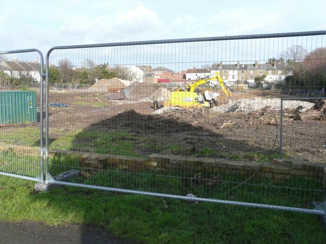
Image: © John Baker Taken: 27 Jan 2014
Seen from a cul-de-sac leading to a cemetery. Planning permission, with conditions, has been granted by Dover District Council under application number DOV/12/00311 for a “residential development comprising of 38 dwellings and 6 flats, construction of vehicular access and associated car parking and landscaping (existing school buildings to be demolished)”. The school referred to was the South Deal County Primary. The new development has been named Stanhope Place. On the left are the backs of houses in Mill Road, while beyond the JCB are the backs of houses in Hamilton Road. See also Image from another angle.
Images are licensed for reuse under creativecommons.org/licenses/by-sa/2.0
Image Location
Latitude
51.214363
Longitude
1.389843