View of the Ilford skyline from Richmond Road
Introduction
The photograph on this page of View of the Ilford skyline from Richmond Road by Robert Lamb as part of the Geograph project.
The Geograph project started in 2005 with the aim of publishing, organising and preserving representative images for every square kilometre of Great Britain, Ireland and the Isle of Man.

There are currently over 7.5m images from over 14,400 individuals and you can help contribute to the project by visiting https://www.geograph.org.uk
View of the Ilford skyline from Richmond Road
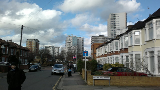
Image: © Robert Lamb Taken: 4 Feb 2014
From left to right, the buildings are: Spectrum Tower (on Hainault Street), Centreways Apartments next to the railway line around the back of the shops on the High Road, the Ilfomation (Ilford's information and tourist bureau) at the back of Hainault Street bus station), Lynton House (Redbridge Council offices) and Raphael House (an apartment block with a Costcutter supermarket below it) on the High Road next to the Griggs Approach flyover, built on the site of an old nightclub). Looking north-northwest from the junction with Belmont Road.
Images are licensed for reuse under creativecommons.org/licenses/by-sa/2.0
Image Location
Latitude
51.558788
Longitude
0.078032