Flood in field at Owslebury Bottom
Introduction
The photograph on this page of Flood in field at Owslebury Bottom by Peter Facey as part of the Geograph project.
The Geograph project started in 2005 with the aim of publishing, organising and preserving representative images for every square kilometre of Great Britain, Ireland and the Isle of Man.

There are currently over 7.5m images from over 14,400 individuals and you can help contribute to the project by visiting https://www.geograph.org.uk
Flood in field at Owslebury Bottom
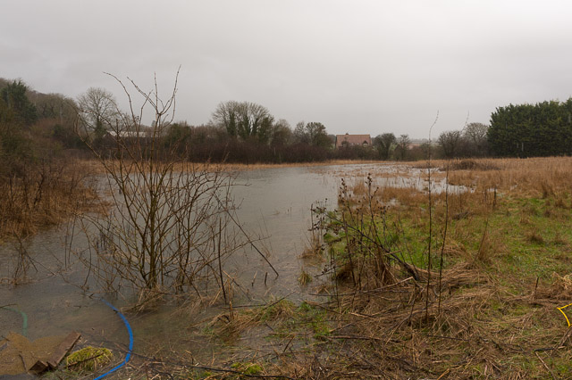
Image: © Peter Facey Taken: 4 Feb 2014
Looking from the road at Owslebury Bottom towards Stags Lane. The house seen is South Longwood which was high and dry, but the one to its right, named Staggs Gate, was flooded, see Image A culvert here was supposed to carry the field water across the road, but it seemed to be of insufficient size. Hence its flow was being assisted by pumps. From here the water flowed across fields to Image
Images are licensed for reuse under creativecommons.org/licenses/by-sa/2.0
Image Location


Leaflet Map data © OpenStreetMap
Latitude
51.016415
Longitude
-1.268195